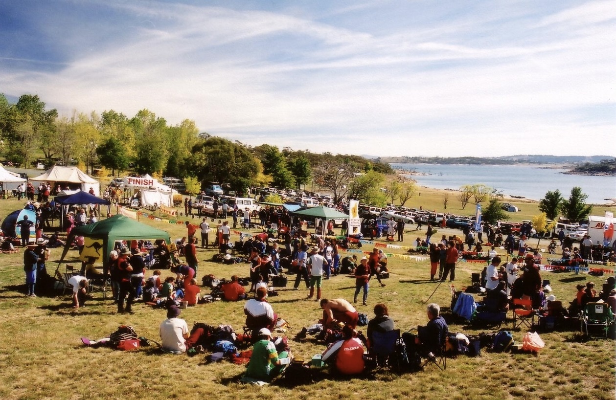
A little over 20 years ago, I was introducing my wife and some friends to orienteering in Jindabyne. With my family involved in the Scottish 6 Days since its 1977 inception, I had been orienteering since before I could walk, and reading orienteering maps was second nature to me.
Not second nature to the rest of the gang though! Despite them being active and comfortable navigating, they didn’t find it obvious how to read some of the features on orienteering maps.
This gave me the idea to help other newcomers to orienteering with a series of simple exercises that would provide a translation between what people might see on the ground, and what could be seen on an orienteering map. It would be a short phrasebook for a foreign visual language.
And I’ve just been reminded that the exercises I went on to create are still in use 20 years later, in Australia, and globally in other languages too!
Still live in 2025
I received an email recently from an orienteer in South Australia looking for a current link to the exercise teaching how to orient a map with a compass.
This exercise and all the others were originally hosted by and widely consumed from Orienteering Australia, but all that remains today is a tantalising digital ghost of a forgotten development instance.
To ensure they remain available, I now host these map training exercises on safetydave.net. I’m always pleased to receive enquiries like this one!
How it started
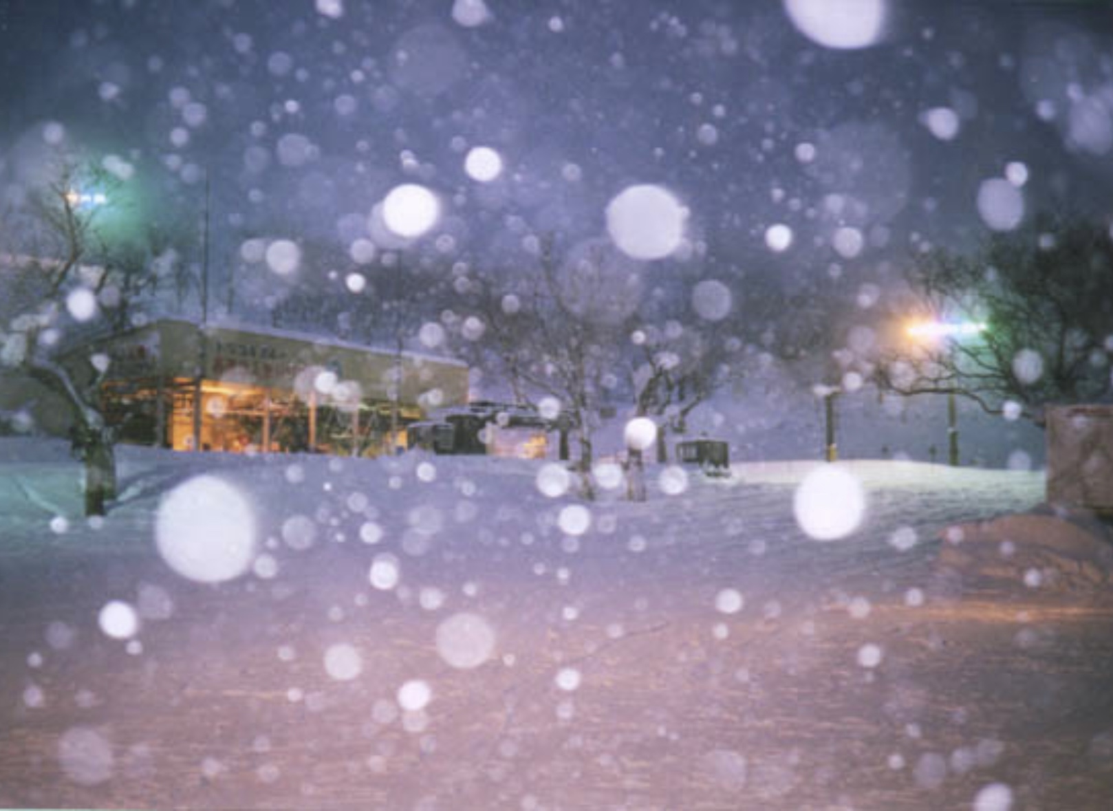
It started a long way from Australian orienteering; snowboarding at Niseko Grand Hirafu in Hokkaido, Japan, where I’d returned in 2005 after first visiting in 1999.
Originally intending to visualise snowboarding runs and rideable terrain (an idea predating Strava’s aquisition of FATMAP by decades), I had built a 3D model of Mt Niseko-Annupuri using Rhino3D. Raising imported 2D contours vertically and then fitting a NURBS surface delivered a 3D land surface model with superimposed contours, which looked pretty sweet.
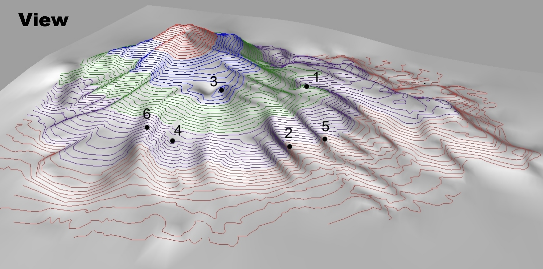
Instead I used this model for the first orienteering exercise I created. It required the reader to match locations seen in this perspective view to the corresponding locations in an overhead view of the contours, the view of an orienteering map. I simply laid this out as a single PDF page.
I thought this worked well and was easy to use in any location, including out in the field, which thankfully dissuaded me from doing anything more complicated (like the immersive online 3D worlds of VO2max). I got good feedback and the format was also easy to replicate and extend, so I continued to work through further exercises introducing the various features to be found on orienteering maps.
Completing the course
Version 1
Version 1 progressed generally from simpler, common features typically used by newcomers, like paths and fences, through to more subtle, complex or subjective features like vegetation, water, rock, etc, used for more advanced navigation. The sequence is more or less just what I thought would be useful next when working through a typical orienteering map legend.
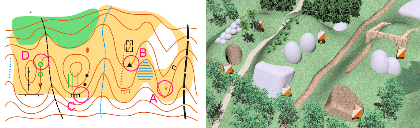
For most exercises, I envisaged a base scene with customisable elements – for instance a path might be swapped with a fence, or a thicket with a clearing – and then created a 3D model of this scene in Rhino3D in parallel with a map of the scene in CorelDraw v10.

This made it somewhat efficient to create multiple variants of the scene and the map. Rearranged, these variants could then be used in a matching exercise, which was intended to challenge the reader to differentiate between similar symbols, as well as providing a visual definition for each symbol as a reference for later.

I used the (now discontinued) Flamingo renderer to create fairly lifelike (for 2005) renderings of grass, earth and vegetation from the 3D models.
Version 2
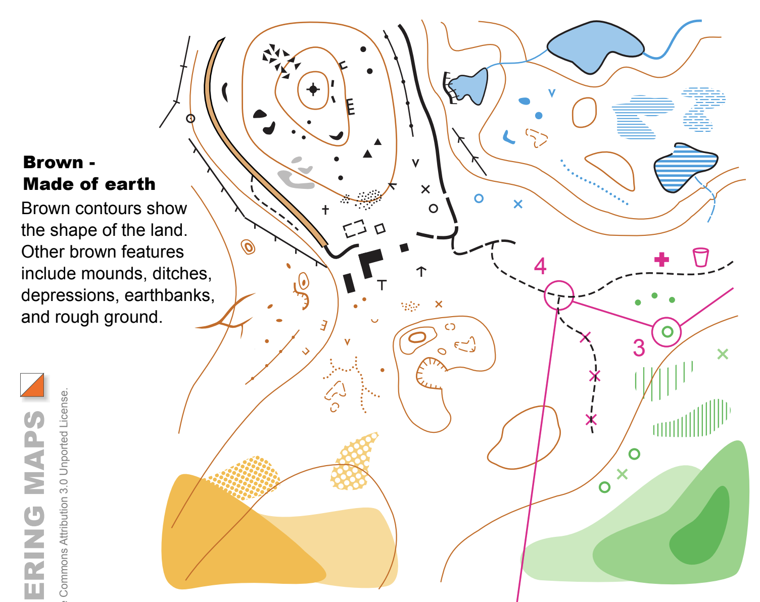
I later created the version 2 exercises, which were overall very similar to version 1, but differed in that they were:
- Structured around the different colours of the map, such as black for rock, brown for earth and blue for water, with basic and advanced exercises for most colours,
- Re-drawn using Inkscape, for both the maps and overall page layout
- Released with all sources (SVG & JPEG & 3DM) under a permissive Creative Commons license
How it’s going
I don’t fully know, but it’s going!
The exercises are distributed as PDFs, and I’ve granted every request to download, use and adapt the exercises I’ve received from individuals, educators and orienteering clubs. There may be 100s or 1000s of digital and hardcopy PDFs floating around in personal collections and orienteering clubs around the world, but I don’t know. Maybe I should have dedicated them to my wife for her inspiration!
I’ve been tickled to see them translated from the original English into Portuguese, Spanish, Slovenian and Traditional Chinese.
I’ve been able to re-use the Inkscape objects and styles I created to make my own maps of special places like Cape Conran Coastal Park and Saltwater Creek Campground.
I’ve been especially pleased that the friends for whom I originally created these exercises have gone on to share them with their children, when introducing the next generation to orienteering.
And just tonight I learned that I can add to this list the lovely people of Northeastern Ohio Orienteering Club, thank you for the acknowledgement, and I hope from here these exercises help still more people to enjoy orienteering!